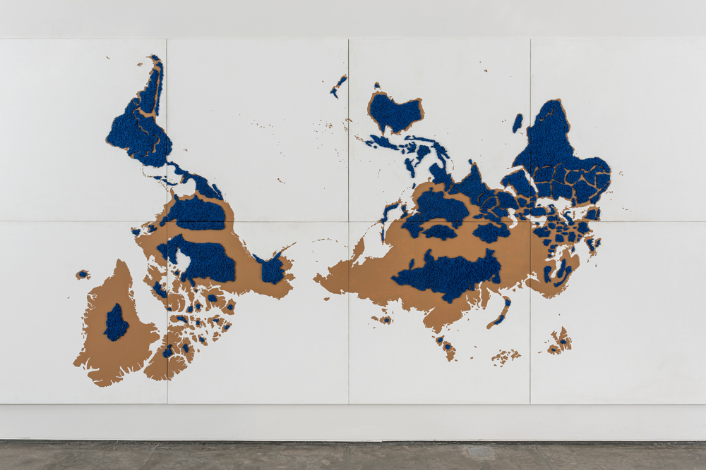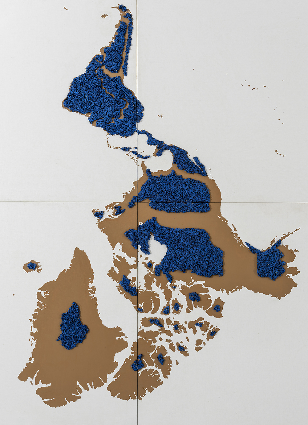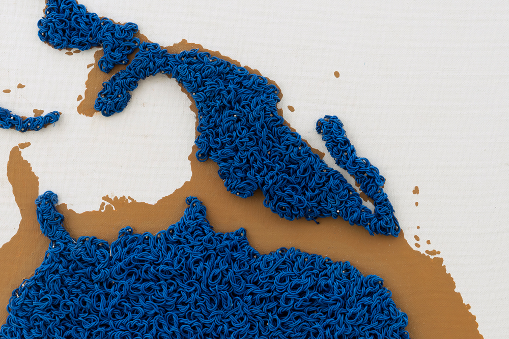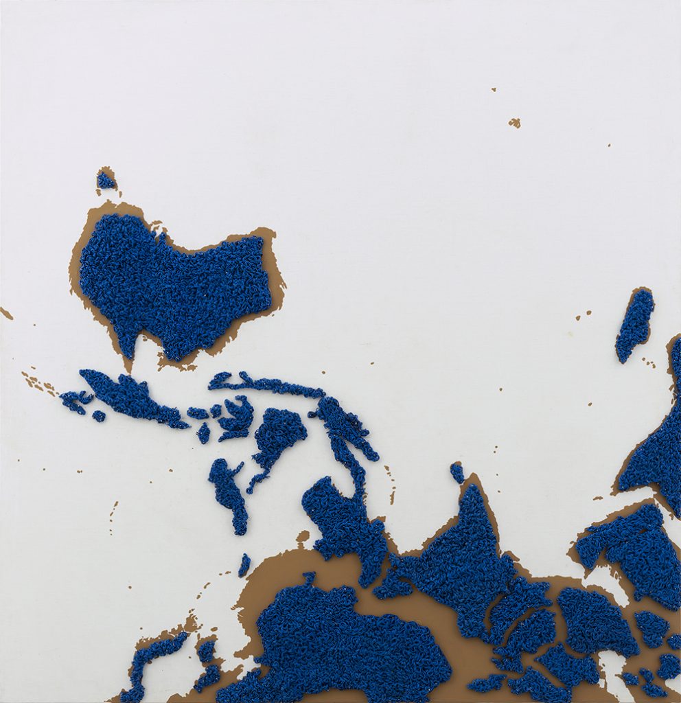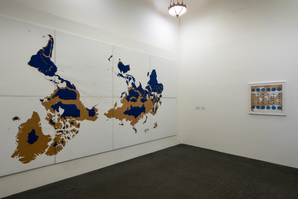
Terra Firma: Chronicle of Flawed Calculations
2024
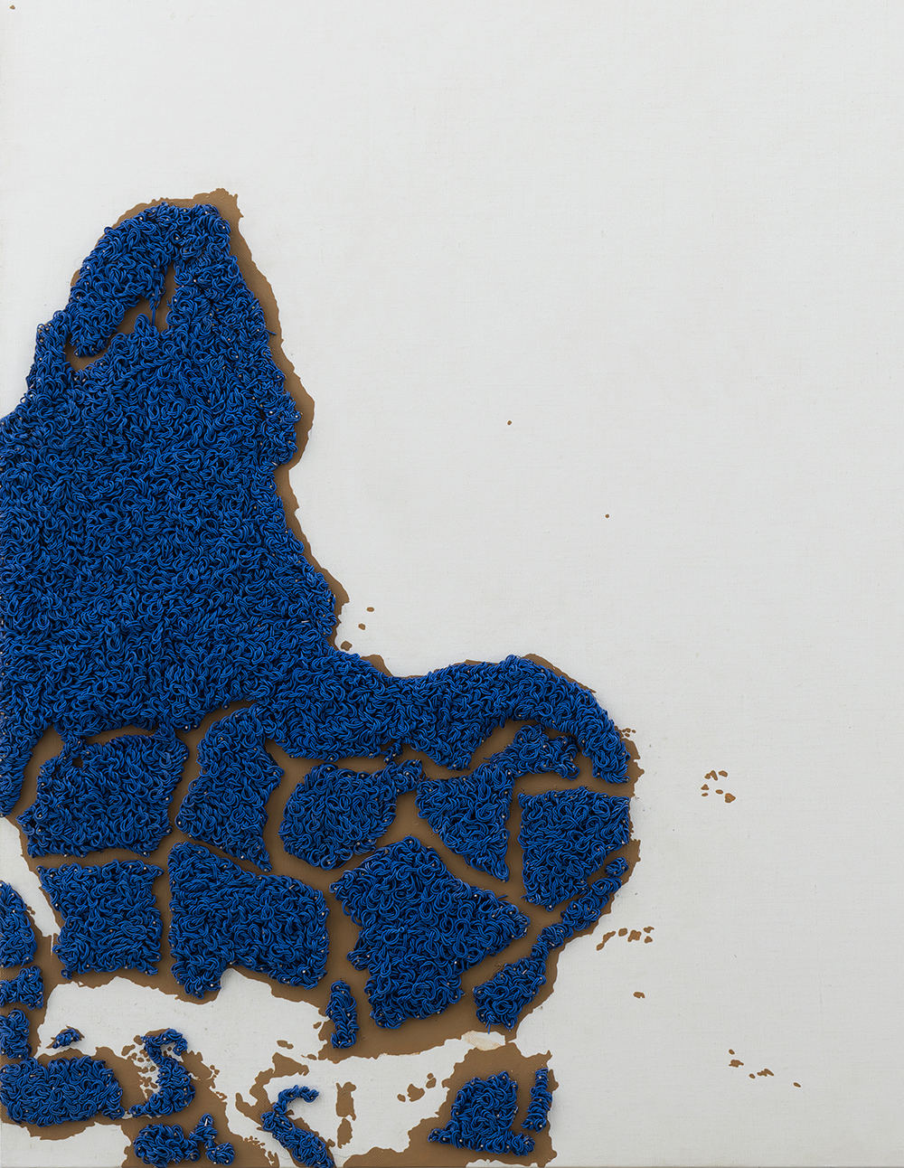
electric wires, nail pins, acrylic on linen, mounted on board
Set of 8 : 46 x 46 in. I 117 x 117 cm. each
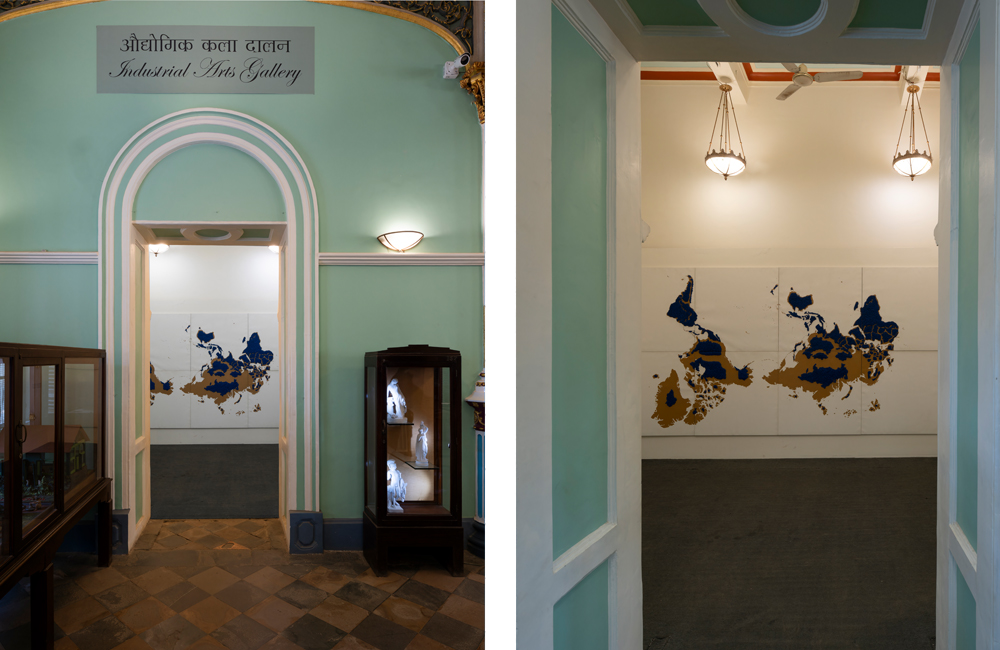
Reena Kallat renders a map that appears uncanny in its orientation and scale. As an exercise in counter-cartography, it subverts conventional views of the world, by unsettling our inherited perceptions of geography and power. Installed within this colonial-era Victorian Museum, it challenges systems of knowledge once used to justify empire, inviting viewers to carefully reconsider the tacit structures governing us and the institutions that preserve them.
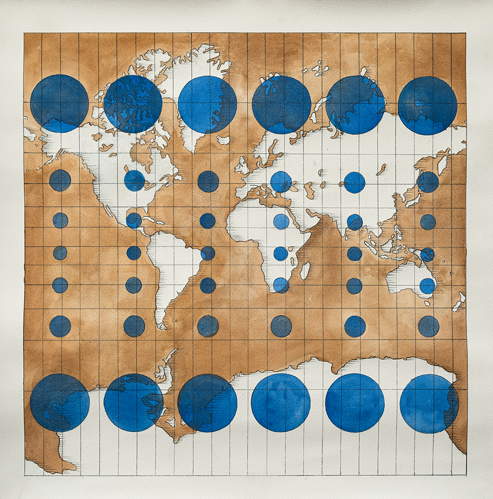
While the Flemish geographer, Gerardus Mercator’s 1569 projection became a standard representation of the planet and has served as a reliable nautical guide for centuries, it normalized the ‘north-up’ and ‘Atlantic-centred’ views of the world, inflating the sizes of countries farther from the equator. This distortion particularly enlarged landmass sizes privileging the Global North, by feeding into imperialist assertions of superiority over the ‘South’ as evidenced, for instance, by the shrunken depiction of the African continent.
Kallat’s work acts as a corrective map trying to reverse this bias embedded in the collective subconscious by rendering landmasses through meticulous research, based on their actual size and shape. By flipping familiar orientations to place, the so-called ‘Global South’ above the equator, it compels audiences to reckon with an unfamiliar, yet evocative perspective. Given the spherical nature of the planet which doesn’t inherently provide a reference for what is up or down, Kallat’s choice to invert the two-dimensional orientation underscores the arbitrariness of ‘up’ and ‘down’ on a globe and exposes the political charge of cartographic conventions.